isomap/iso-karte
In cartography, the isomap is a map made of contour lines (also isoline,or isopleth) joining points of equal elevation (height) above a given level, such as the sea level for a landscape.
We can use this technique to map the topography of our body, and we choose instead of the sea, the floor as the given level.
In der Kartografie ist die Isokarte eine Karte, die aus Höhenlinien (auch Isolinien oder Isoplethen) besteht, die Punkte gleicher Höhe über einem bestimmten Niveau (z. B. dem Meeresspiegel einer Landschaft) verbinden.
Wir können diese Technik nutzen, um die Topografie unseres Körpers abzubilden, und wir wählen statt des Meeres den Boden als gegebene Ebene.
Score:
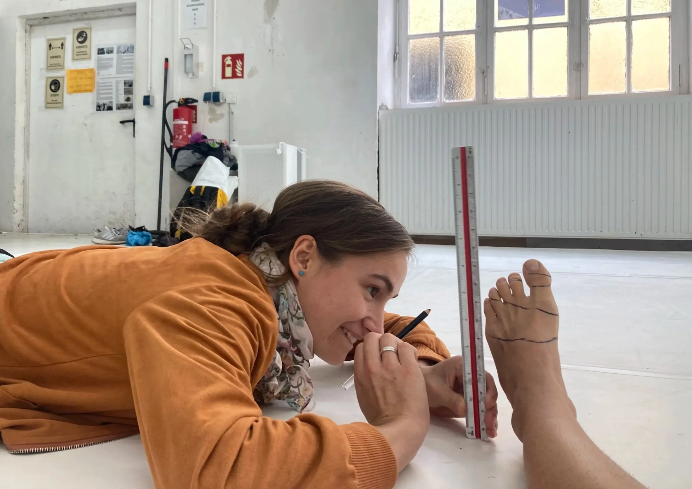
You can make the Iso map of any part of your body, (or of your whole body). To do this score it's easier to be two people:
One person takes their clothes off and place on the floor the body part they want to map. The other person uses a make-up pen to draw horizontal lines on the body parts, each line needs to have an equal distance between them. (for example if the first line is one centimeter above the floor, the second line will be 1 cm above the first line and so on).
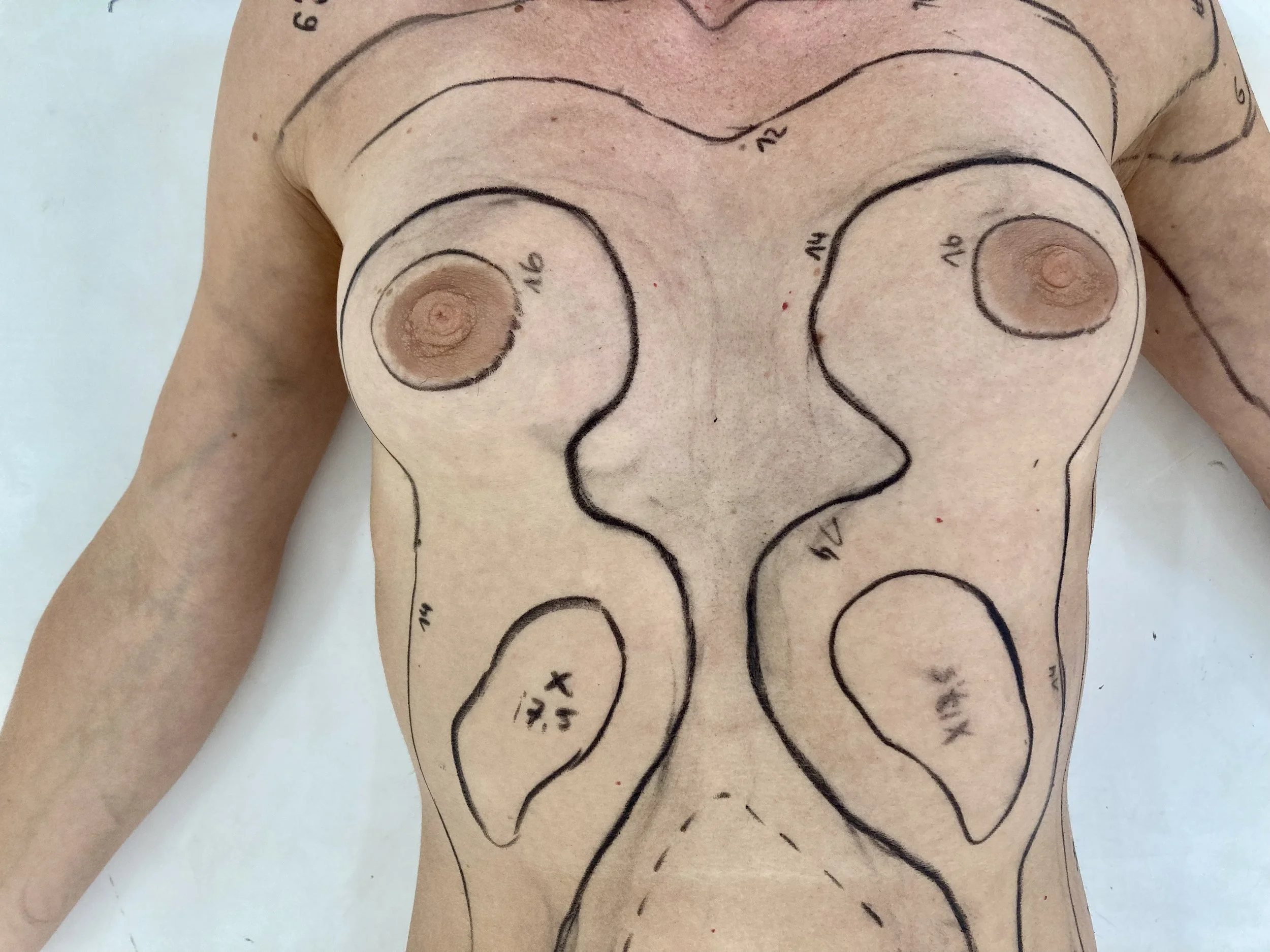
When this is done, take a picture from above. This is your Isomap.
Du kannst die Iso-Karte von jedem Teil deines Körpers (oder von deinem ganzen Körper) erstellen. Für diese Aufgabe ist es einfacher, zwei Personen zu sein: Eine Person zieht sich aus, und legt den Körperteil, den sie abbilden möchte, auf den Boden. Die andere Person zeichnet mit einem Schminkstift horizontale Linien auf die Körperteile. Jede Linie muss den gleichen Abstand haben. (z. B. wenn die erste Linie einen Zentimeter über dem Boden liegt, liegt die zweite Linie 1 cm über der ersten Linie, und so weiter).
Wenn dies geschehen ist, mach ein Foto von oben. Dies ist deine Iso-Karte.